Apple Maps refresh — new hiking features are welcome but these are the ones I really wanted
Topographic maps are nice, but up-to-date trail info is better

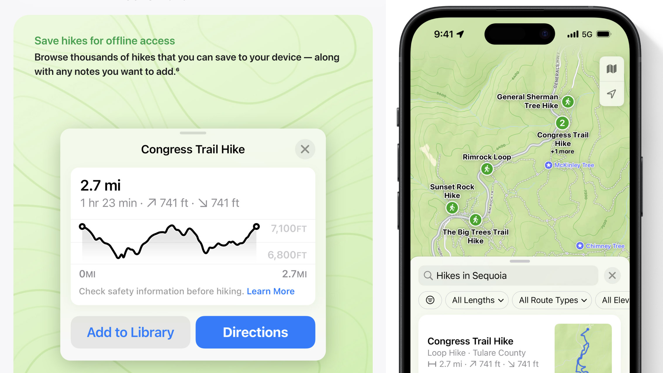
I always get excited when tech companies talk about hiking. So, when Apple announced that Maps would soon be getting topographic maps and support for hiking trails via iOS 18, I was extra jazzed.
The latest version will also let you create and save your own trail routes, download trails for offline viewing and provide turn-by-turn directions. It additionally supports popular trails at all 63 U.S. National Parks.
These updates are proof that Apple is taking outdoor recreation more seriously than ever. However, the new hiking features aren’t enough to convince me to use Apple Maps on my next outdoor adventure as they fall well short of what other popular hiking apps offer.
For Apple Maps to truly win me over, here are five hiking-centric features I’d like to see added by the next iOS version launch or sooner.
1. Detailed park and trail advisories
It’s awesome to hear that hiking trails for all 63 U.S. National Parks will soon be added to Apple Maps for users to explore. However, it would be even more useful if park and trail pages offered up-to-date visitor information about things like entry fees, hours, accessibility, closures and wildlife in the area.
After all, preparing for an outdoor adventure involves more than simply picking a trail, jumping into the car and heading toward the forest. A little bit of research can be the difference between an awesome day under the trees and a disappointing one — there’s nothing more crushing than showing up to a completely full trailhead parking lot.
Additionally, with the number of folks visiting National Parks near an all-time high, according to the National Parks Service, planning ahead is more important than ever.
2. Information on current ground and weather conditions
Similarly, trail conditions throughout the U.S. vary considerably depending on the season. And those with lots of elevation gain tend to have even more variability no matter the time of the year.
This is why information on current ground conditions and weather throughout the route is so valuable to hikers and something Apple should consider bringing to Maps as well.
3. Trail previews with recent photos
While I’m at it, current photos from the trail reflecting the most recent conditions would also be a huge plus for Apple Maps. My favorite hiking app, AllTrails, recently tweaked its photo galleries for trails and parks to more dynamically reflect current conditions, sourcing from user uploads. Apple would be wise to take a similar approach.
4. Built-in safety features
It’s best practice to inform others of your plan and estimated return time before heading out on any outdoor adventure.
In recent years, many hiking-centric apps and device-makers have taken this a step forward and let loved ones monitor your progress in real-time, with ease. Garmin’s LiveTrack feature, available on the brand’s best GPS smartwatches, is one of the better-known examples.
Again, my go-to hiking app, AllTrails, also lets you generate a Live Share link to send to friends or family members before starting your hike, right from the app, with all the important trip details including the your current location, trail route, and estimated completion time.
Apple already offers something similar in the form of the Check In tool, introduced in iOS 17 last September and available via the Messages app. Integrating it into Apple Maps for hikers seems like a natural (and welcomed) progression.
5. Off-trail warnings
I’m excited to see Apple add the ability to use turn-by-turn directions while hiking in Apple Maps but to make the feature extra powerful, the addition of off-trail warnings when you’ve made a wrong turn would be even better.
Hiking apps have offered this for a while, whether using voice-guided turn-by-turn or simply tracking your hiking progress via GPS. And a polite buzz of the phone is all that’s really needed to inform folks that they’ve made missteps.
More from Tom's Guide
Sign up to get the BEST of Tom's Guide direct to your inbox.
Get instant access to breaking news, the hottest reviews, great deals and helpful tips.

Dan Bracaglia is the Tom’s Guide editorial lead for all things smartwatches, fitness trackers and outdoor gear. With 15 years of experience as a consumer technology journalist testing everything from Oura Rings to instant cameras, Dan is deeply passionate about helping readers save money and make informed purchasing decisions. In the past year alone, Dan has assessed major product releases from the likes of Apple, Garmin, Google, Samsung, Polar and many others.
An avid outdoor adventurer, Dan is based in the U.S. Pacific Northwest where he takes advantage of the beautiful surroundings every chance he gets. A lover of kayaking, hiking, swimming, biking, snowboarding and exploring, he also makes every effort to combine his day job with his passions. When not assessing the sleep tracking and heart rate accuracy of the latest tach gadgets, you can find him photographing Seattle’s vibrant underground music community.
