Google Maps Gets Offline Mode; Google Earth 3D Rendering
Google Maps Mobile will get an offline mode, Street View will get a backpack-mounted camera, and Google Maps Mobile will receive 3D models to entire metropolitan areas.


On Wednesday Google revealed an offline mode for Google Maps on Android, 3D imagery for Google Earth Mobile, and a new method for tracking all our freeways, side streets and dirt roads for Street View. Indeed, it was a busy day for the search engine giant.
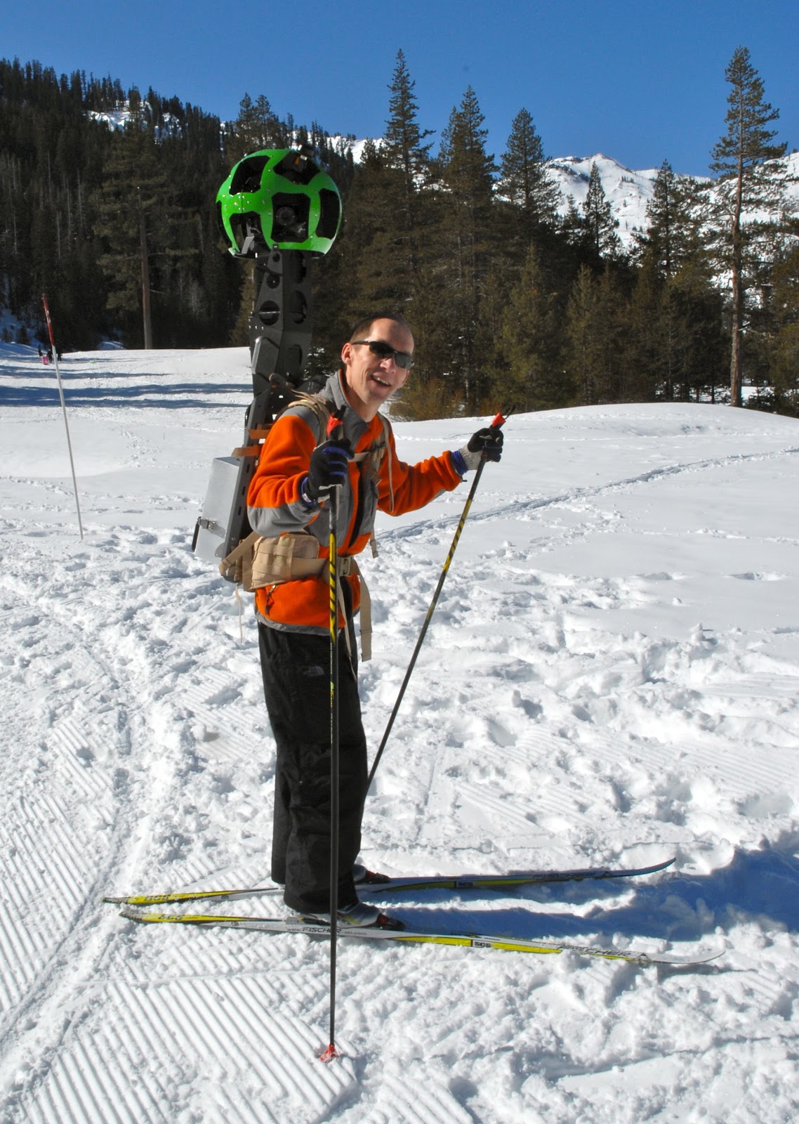
For starters, Google has added an additional element to its arsenal of cameras used in Street View. Up until now, it used cars, trikes, snowmobiles and trolleys to map the entire world. But now there's Street View Trekker, a camera system that's mounted on a backpack. This means Google can set out on foot and photograph places that were inaccessible by vehicles like portions of the Grand Canyon or the North Pole. In the provided image (right), Luc Vincent, engineering director, is taking the Street View Trekker for a trial run in Tahoe. Looks heavy, no?
With better means of mapping the globe, Google can now focus on accuracy. The company admits that it has a way to go because the world is constantly changing. After all, new houses, cities and parks pop up all the time. It's a never-ending job to keep up with all these changes (not to mention way more work than Google has resources for) -- that's why Google has provided means for user feedback via the Report a Problem tool and via Map Maker tools, launched back in 2008.
"By cross-checking the data we have, we can significantly improve the accuracy of our maps," writes Brian McClendon, VP of Engineering, Google Maps, said in a blog. "Turns out our users are as passionate about the quality of Google Maps as we are, and they give us great feedback on where we can do better. We make thousands of edits a day based on user feedback through our Report a Problem tool and via Map Maker."
But as of today, these tools will be expanded into South Africa and Egypt. Ten more countries will be added in the next few weeks including Australia, Austria, Belgium, Denmark, Finland, Liechtenstein, Luxembourg, New Zealand, Norway and Switzerland, he said.
The third part of Google's Maps-based announcement, usability, concerns the mobile version for Android. In the next few weeks, users will be able to take maps offline from more than 100 countries. This will be extremely handy in situations where a data connection is unavailable such as out in rural areas or in the subway. An actual release date was not specified.
Finally there's Google Earth. The company has provided textured 3D buildings since 2006, but Google is now adding 3D models to entire metropolitan areas in the mobile version. "This is possible thanks to a combination of our new imagery rendering techniques and computer vision that let us automatically create 3D cityscapes, complete with buildings, terrain and even landscaping, from 45-degree aerial imagery," McClendon reports. "By the end of the year we aim to have 3D coverage for metropolitan areas with a combined population of 300 million people."
Get instant access to breaking news, the hottest reviews, great deals and helpful tips.
"I have been working on mapping technology most of my life," he adds. "We’ve made more progress, more quickly as an industry than I ever imagined possible. And we expect innovation to speed up even more over the next few years. While we may never create the perfect map… we’re going to get much, much closer than we are today."
To see the new 3D imagery for Google Earth Mobile, check out the video below:
Kevin started taking PCs apart in the 90s when Quake was on the way and his PC lacked the required components. Since then, he’s loved all things PC-related and cool gadgets ranging from the New Nintendo 3DS to Android tablets. He is currently a contributor at Digital Trends, writing about everything from computers to how-to content on Windows and Macs to reviews of the latest laptops from HP, Dell, Lenovo, and more.
-
skaz I'm definitely looking forward to offline mode. Wonder how much room will be needed for local storage of the maps.Reply -
Google heard Apple was making a far superior Maps app and was going to introduce it next week, so it had to announce its CRapp early and unfinished just to steal Apple's thunder.Reply
Nothing new here, seeing as how Google's business model is based on stealing from Apple. -
memadmax I hope this works on pc/laptops(offline)Reply
Maintaining a wireless(cellular) always on connection is expensive...
This is what I need for my job before you go harping on me about GPS on cellphones/Garmin GPS devices..... -
livebriand Finally! I thought they already had some limited offline functionality though (it can precache maps, but you can only use it as a GPS if you start that route and load everything for it ahead of time, no changing the route later during the trip).Reply -
beardguy Hopefully offline mode will work with satellite images as well, and not just maps. This would be a really useful tool to see the terrain when backpacking, where I usually have no signal.Reply
Sweet! -
eddieroolz Backpacks to map the world eh? I wonder if there'll be a hidden wireless antenna in there too.Reply -
jonnyhuk2 Offline mode - You've been able to pre-cache 10 areas of 20x20 mile squares for ages. Whilst handy, it is limited, so this just sounds like an upgrade rather than something new.Reply
What we do need is routing done on the phone when you have no data signal. If you're driving in the country and deviate off your Google satnav route, it tries to re-route you but of course fails with no data signal... you're suddenly lost!
