Google Maps just got a huge Street View upgrade — and you can now travel back in time

Google Street view car
(Image credit: Shutterstock)

Google Earth is getting an interesting new feature where you'll soon be able to "travel back in time." 

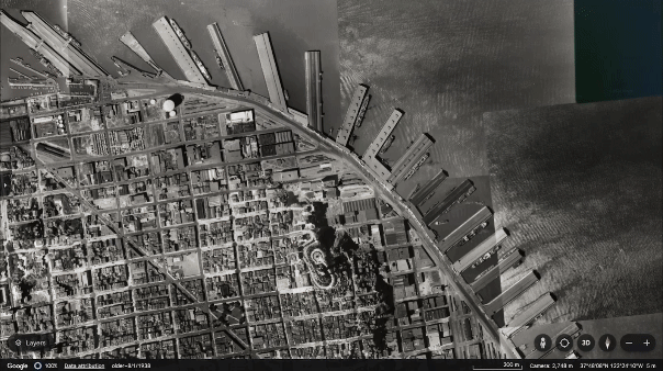
The new feature, announced in a Google blog post along with Street View updates, allows you to view historical satellite and aerial images on Google Earth. Google claims that some pictures go as far back as 80 years. 

It's a way to see how areas have changed over time or how natural and man-made events quickly altered the geography of a place. An example Google showed was the Lake Oroville reservoir in northern California. After years of droughts, it was at the lowest it had ever been. However, an unprecedented series of rains that hit the state in 2023 filled the reservoir to maximum capacity. 

GIF of the San Francisco Wharf from 1938to 2024

(Image credit: Google)

In Street View, Google updates imagery in 80 countries with new images from places like Australia, Brazil, Mexico, New Zealand, Uruguay and more. 

Google says this is possible thanks to a new, more portable Street View camera introduced in 2022. "As our planet changes, this updated imagery helps keep the map fresh for people everywhere," Google says in their post.

The update includes Street View in four countries that have never had it: Bosnia and Herzegovina, Namibia, Liechtenstein and Paraguay. 

If you're like me and enjoy exploring places like Street View, these updates and countries will be a fun way to spend an afternoon.

Street View imagery taken from the bridge overlooking Diamond Beach in southeast Iceland, where icebergs float in the water.

(Image credit: Google)

Finally, Google announced that they are working on sharpening satellite images in Maps, which will allow you to see "a brighter, more vibrant globe." 

Part of this included utilizing AI-powered cloud removal technology trained to remove things like clouds, cloud shadows, haze and mist. Google claims that this model is trained to retain real-world weather patterns and keep them visible on the maps, like "ice, snow, and mountain shadows."

More from Tom's Guide

TOPICS
Scott Younker
West Coast Reporter

Scott Younker is the West Coast Reporter at Tom’s Guide. He covers all the lastest tech news. He’s been involved in tech since 2011 at various outlets and is on an ongoing hunt to build the easiest to use home media system. When not writing about the latest devices, you are more than welcome to discuss board games or disc golf with him. 

Read more
How to tour the Super Bowl stadium virtually with Google Maps
Google Maps glitch is purging Timeline data — what we know
Google Maps app icon on iPhone
Google Maps has 3D Map navigation — here’s how to activate it
How to tour the Super Bowl stadium virtually with Google Maps
Google Maps is adding this new feature for millions of drivers to make your ride safer
Google Maps
Google Maps just got a huge iPhone-inspired upgrade with Android 16 beta — here's how it works
Pixel Studio showing people illustration
Pixel Studio can finally generate people — and that's not the only change Google is bringing to Pixel phones
An image of a photo displaying the Google Map logo with maps in the background
Google Maps is changing Gulf of Mexico to Gulf of America following Trump order
Latest in Mobile Apps
Google wallet app on screen
Google Wallet now lets kids to make supervised contactless payments and use digital passes — what you need to know
How to tour the Super Bowl stadium virtually with Google Maps
Google Maps glitch is purging Timeline data — what we know
Gboard app logo on mobile phone resting on a keyboard
Google Gboard redesign has already angered users — and I can see why
Waze app on iPhone in car
Forget Google Maps — Waze just got a huge upgrade that will help millions of drivers
A photo of the Apple Maps app tile displayed on an iPhone screen
Apple Maps may soon get ads, letting businesses pay to boost visibility
How to delete TikTok
TikTok confirms return to Apple and Google app stores — here’s what we know
Latest in News
Apple Watch Series 10
Future Apple Watch models could get a surprising new feature — what we know
iPhone 16 Pro vs iPhone 16 Pro Max in hand showing displays
Forget iPhone 17 — iPhone 18 could get this huge upgrade
The new Husqvarna iQ series robot lawn mower.
Husqvarna’s new robot mowers offer GPS for less
Rendered images of rumored foldable iPhone.
Foldable iPhone report just revealed key details — here's what we know
NYTimes Connections
NYT Connections today hints and answers — Sunday, March 23 (#651)
NYT Strands on a cellphone
NYT Strands today — hints, spangram and answers for game #385 (Sunday, March 23 2025)
  • Fox Tread3
    September 30, 2024 - I purchased the program that became Google Earth from the company that originally published the App. years ago. It was great news when Google purchased the App/program/utility. and has done wonderful things to improve it over the years. Google Earth is one of the few Apps I own, and often use it find places I'm interested in because of News events, and to explore places that are used to film movie and TV productions. Also, as time permits, I use it to explore places that I will never be able to visit. Obviously, it's not the same as actually visiting those places, but it is a lot more environmentally friendly, and costs nothing. Google Earth has had a "back in time" function for quite a few years. It has been possible to see what some places and areas looked like in the past for some time now.
    Reply